Cyprus is located in one of the most seismically active regions of the Eastern Mediterranean. Although destructive earthquakes are rare, the island regularly experiences small to moderate tremors. These phenomena are related to Cyprus’s geological location—the collision point of the African and Eurasian tectonic plates. Knowledge of seismic activity, earthquake history, and safety precautions during tremors is important for residents and tourists.
Contents
- 1 Geological features of the region
- 2 Seismic activity in Cyprus
- 3 Historical earthquakes
- 4 Earthquake-resistant construction
- 5 Monitoring and warning system
- 6 Recommendations for behavior during an earthquake
- 7 Environmental and economic consequences
- 8 Scientific research and forecasting
- 9 Why do earthquakes occur regularly in Cyprus?
Geological features of the region
Cyprus is located on the so-called Cyprus Arc, a subduction zone where the African Plate slowly moves northward and subducts beneath the Anatolian Plate, part of the Eurasian continent. This movement causes significant geological stress in the Earth’s crust, leading to regular earthquakes of varying magnitude.
The greatest activity is observed along the southern and southwestern coasts of the island—in the areas of Paphos, Limassol, and Polis. The epicenters of most tremors are located beneath the seafloor at depths of 10–30 kilometers. Less active zones are located in the Troodos Mountains and north of Nicosia.
Seismic activity in Cyprus
According to the Cyprus Geological Survey Department, between 200 and 500 tremors are recorded annually, most of which have a magnitude below 3.0 on the Richter scale and are not felt by the population. Strong earthquakes (with a magnitude above 5.0) occur on average once every 10 to 15 years.
The island’s modern seismological stations are connected to an international monitoring system and can track even the slightest vibrations. The largest active faults are the Paphos, Limassol, and Arkadian faults, located along the coast.
Historical earthquakes
Cyprus’s seismic history spans thousands of years. Archaeological and written sources indicate that earthquakes have repeatedly impacted the island’s fate.
Earthquake of 76 AD
One of the first recorded events destroyed the ancient city of Salamis on the east coast. The city was subsequently rebuilt, but a significant portion of the buildings remained underground.
The great earthquake of 332 AD
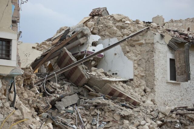
The coastal towns of Curium, Paphos, and Polis were affected. According to historians, the tremors destroyed the Curium amphitheater, temples, and aqueducts. This event is considered one of the most powerful in the history of Cyprus.
Earthquake of 1222
It occurred in the Paphos region and was one of the most destructive. Its magnitude was estimated at around 7.0. The powerful tremors destroyed Byzantine churches, fortresses, and coastal settlements. Numerous references to this event have been preserved in chronicles and monastic records.
Earthquake of 1491
Famagusta and Nicosia suffered damage. Sources report the deaths of hundreds of residents and the destruction of city walls.
The 1953 Paphos earthquake
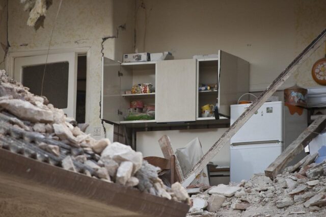
One of the most significant events of the 20th century, the magnitude 6.5 tremor damaged over 4,000 homes, particularly in the villages of Kissonerga, Emba, and Chloraka. Forty people died, and hundreds were left homeless. This earthquake inspired the development of the first building codes that took seismic resistance into account.
Earthquakes of the 21st century
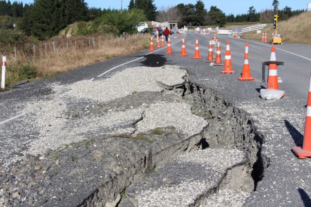
In recent decades, the island has experienced several significant tremors—in 1996, 2015, and 2022. The most significant recent event occurred in January 2022, when a magnitude 6.1 earthquake was recorded in the Paphos area. It was felt throughout Cyprus and even in Egypt, Israel, and Turkey, but caused no significant damage thanks to the depth of the epicenter and modern construction standards.
Earthquake-resistant construction
Following the 1953 earthquake, the Cyprus Government adopted the Cyprus Seismic Code, which is regularly updated in accordance with the European Eurocode 8 standard.
Its main principles include:
- use of reinforced concrete and steel structures;
- mandatory design of buildings taking into account dynamic loads;
- quality control of materials and foundation strength;
- placement of large objects on stable geological sites.
Since 1994, compliance with seismic standards has been mandatory for building permits. Thanks to this, modern buildings in Cyprus can withstand tremors of up to magnitude 6.5 without serious damage.
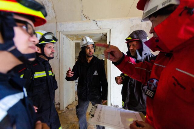
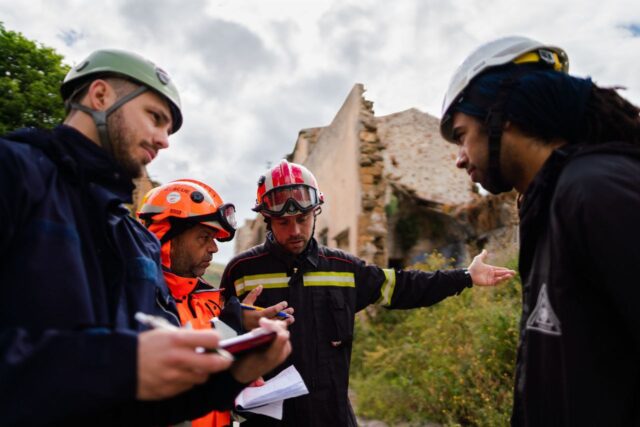
Monitoring and warning system
The Cyprus Geological Survey operates a network of seismic stations located throughout the island. Data on every tremor is instantly transmitted to international centers in Athens and Rome.
In the event of an earthquake, the National Civil Defense Plan is in effect, which includes:
- automatic alerting of emergency services;
- temporary suspension of traffic on bridges and tunnels;
- coordination of rescue operations;
- providing information to the public through the media and mobile applications.
Although Cyprus is not considered a high-risk tsunami region, sea level monitoring systems have been installed along the coast to detect abnormal waves following tremors in the Eastern Mediterranean.
Recommendations for behavior during an earthquake
Despite the relatively low frequency of strong earthquakes, it is important to know basic safety rules:
During tremors:
- stay indoors, stand in a doorway or under a supporting beam;
- stay away from windows, cabinets and heavy objects;
- do not use the elevator;
- if you are outside, stay away from buildings, trees and wires.
After the earthquake:
- leave the building after the shaking stops, avoiding stairs with cracks;
- turn off gas and electricity at the first sign of damage;
- listen to official announcements and do not use the phone unless necessary;
- do not enter damaged buildings until they have been inspected by engineers.
Environmental and economic consequences
In addition to the threat to life and destruction, earthquakes impact the economy and the natural environment. Damage to water systems, roads, and ports requires significant restoration costs. However, thanks to investments in infrastructure and insurance systems, damage from seismic activity in Cyprus is minimized.
Insurance companies offer special policies that cover earthquake risk. Property owners are advised to include this clause in their contracts, especially in coastal areas.
Scientific research and forecasting
Cyprus actively participates in international seismicity research programs in the Eastern Mediterranean. Scientists from the University of Cyprus and the Geological Survey monitor microseismic processes, create hazard maps, and study active faults.
Long-term forecasts are not yet possible, but statistical analysis allows us to estimate the likelihood of strong earthquakes in specific areas. The southern coastal areas—Limassol and Paphos—are considered the most vulnerable.
Why do earthquakes occur regularly in Cyprus?
The island’s seismic activity is a natural result of plate movement. The African plate continues to slowly shift northward at a rate of about 2.5 centimeters per year, creating stress in the Earth’s crust. From time to time, the energy of this movement is released in the form of tremors.
This natural phenomenon cannot be prevented, but its consequences can be minimized through public preparation, engineering measures, and prompt response by services.
Earthquakes in Cyprus are part of the region’s natural geology, but modern technology, strict building codes, and a well-developed monitoring system make the island safe for life. Seismic activity reminds us of the power of nature, but also demonstrates the human capacity to adapt and protect ourselves. Knowing the history of earthquakes and the rules of conduct helps us maintain calm and confidence even during times of natural challenges.